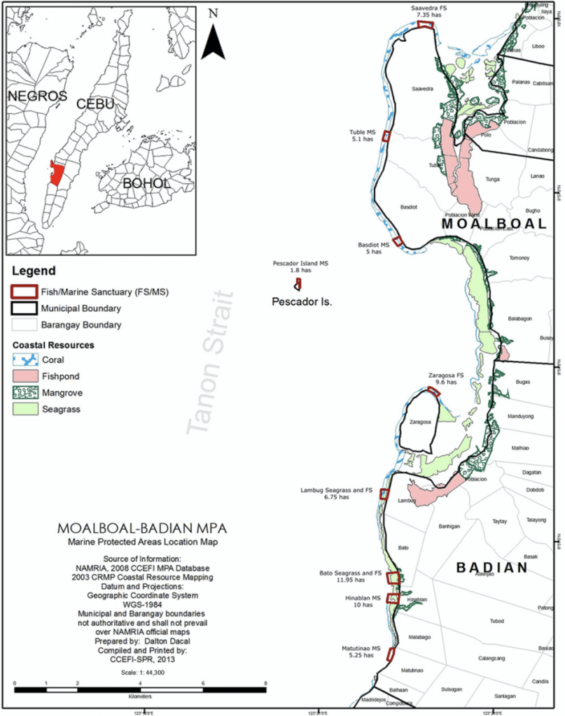
Moalboal lies in the waters of the Tañon Strait, which is a NIPAS (National Integrated Protected Areas System) declared protected area. Moalboal has four locally-declared and managed marine sanctuaries which implement a user-fee system that generates income for the local communities.
Expedition Location

The 2013 Saving Philippine Reefs expedition was held at Moalboal, a premiere domestic and international dive site located about 90 kilometres from the province of Cebu city. Moalboal lies in the waters of the Tañon Strait, which is a National Integrated Protected Areas System declared protected area. It boasts four locally- managed marine sanctuaries which implement a user-fee system that generates income for the local communities.
Moalboal is at the heart of marine bio-diversity in the Philippines and its healthy reefs and steep walls support schools of snappers, jacks, barracudas, sardines, reef sharks, tuna, turtles, passing thresher sharks and even occasional whale sharks.
Critters and macro-life are abundant here and highlights include pygmy seahorses, sardine balls, octopus, nudibranch, electric clams, cuttlefish, ghost pipefish, frogfish and a host of crustaceans.
Expedition Purpose
The purpose of this expedition was to determine the coral reef condition within the marine sanctuaries in Moalboal and some surrounding marine protected areas in neighboring towns such as Badian. The data collected will be used to compare monitoring data collected by CCE and the local community in past years. The expedition results will support the current management of Moalboal and Badian marine sanctuaries and indicate effectiveness of protection from illegal fishing and improper tourism activities in the area.

What data was collected?
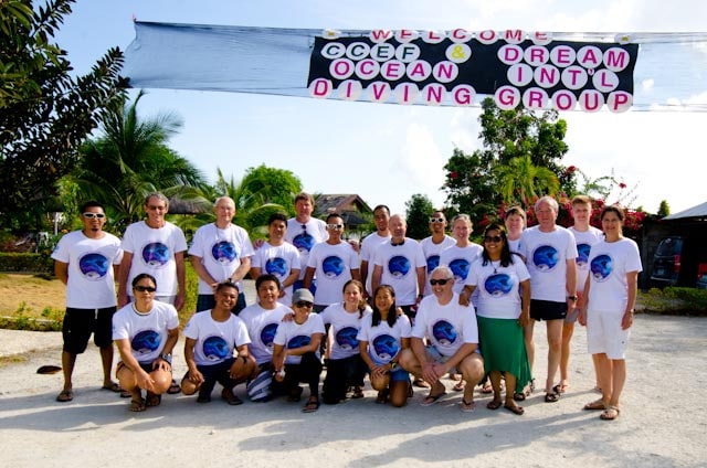
Under the guidance of Principal and Co-Principal Investigators Dr. Alan T. White and Dr. Aileen Maypa volunteers made reef surveys using prescribed methods during morning and afternoon dives and snorkels.
The dive volunteers and staff will make surveys to document the status of the coral reefs in Moalboal and Badian by collecting the following information:
- Percent bottom cover of living coral
- Percent bottom cover of non-living reef substrates (e.g. rock, rubble, sand, dead coral)
- Percent bottom cover of other living substrates (e.g. seagrass, algae, sponges)
- Fish species diversity per unit area
- Total number of fish individuals per unit area
- Total number of fish species on the reef
- Number of indicator species per unit area (e.g. butterflyfish, giant clams, lobsters, Triton shells, Crown-of-thorns seastars and others)
- Presence of large marine life (e.g. sharks, manta rays, Bumphead wrasses, sea turtles,
- whales and dolphins, and others)
- Causes of coral damage
- Presence of visitors of intruders in the area
- Effectiveness of management protection in the area
All the data collected during our expedition was currently being collated and is summarised in the report below which was disseminated to all interested parties in the Philippines and elsewhere. It will help guide and improve management efforts and give us an indication of the condition of the reefs and marine protected areas in Moalboal and Badian, Philippines.
The Results


The coral reefs in Moalboal and Badian appear stable with living coral cover ranging from poor (<25%) to good (>50%). Live hard coral (LHC) cover in the deep zones of Moalboal and Badian MPAs range from fair (35.71±10% in Zaragosa Island) to good (64.92±35% in Saavedra) while it is poor (16.46±16% in Lambog) to fair (33.67±21% in Basdiot) in the shallow zones in 2013. The 2013 survey results show that LHC in the majority of the MPAs decreased in 2013, of which, several declines were significant.
The same decreasing pattern was also observed in the shallow areas. Anecdotal survey evidence suggests that some of the observed decrease in LHC in most of the sites may have been due to the magnitude 6.7 earthquake on February 6, 2012 wherein the Epicenter was between Moalboal and Guihulungan, Negros Oriental. This earthquake caused the sea level to recede and come back with strong waves crushing through the reef walls and damaging corals. Moreover, reef conditions were worsened by the typhoons that traversed through the Visayas at the end of 2012. Considering these factors, the decline in LHC in most sites surveyed is modest and the reefs monitored show a good level of resilience over time.
All reef fish density was highest in Pescador Island at 7387±2732 fish/500m2 followed by Basdiot (6102±3531 fish/500m2) and Saavedra (2928±1059 fish/500m2) while target fish density was highest in Basdiot (2142±2743 fish/500m2) followed by Saavedra (417±446 fish/500m2). Target fish density within MPAs where strict enforcement is present, appears to be improving overtime as compared to outside where heavy fishing pressure is evident. This is also illustrated by the higher species richness inside MPAs compared to the adjacent areas where little or no enforcement is being implemented. Target fish biomass has increased overtime inside the MPAs. A clear picture is presented of the benefits of well protected no-fishing areas as represented by the small MPAs in Moalboal and Badian by the increasing biomass of fish.
Moalboal and Badian Municipalities have been very active in coastal resource management since the establishment of Saavedra Marine Sanctuary and Zaragosa Island Fish Sanctuary in 1987 wherein they are two examples of the well managed small marine protected areas in the Philippines. However, there are still the challenges of sustaining the efforts to enforce the law against illegal activities, strengthen MPA management bodies in other MPAs and the ever growing volume of tourism. Recommendations to further enhance conservation of the area are made herein.
The Organisation
Coastal Conservation & Education Foundation
Coastal Conservation and Education Foundation is a non-profit organisation dedicated to the management and sustainable use of Philippine coastal resources through active leadership and participation of coastal communities and stakeholders. Driven by its passion to create sustainable coasts and actively engage communities, CCEF develops and disseminate tools, techniques and research for better marine management, while promoting integrated coastal management approach that includes marine protected areas (MPAs) localized law enforcement and other participatory best practices.
Find out more info here: https://www.coast.ph/
Partners


