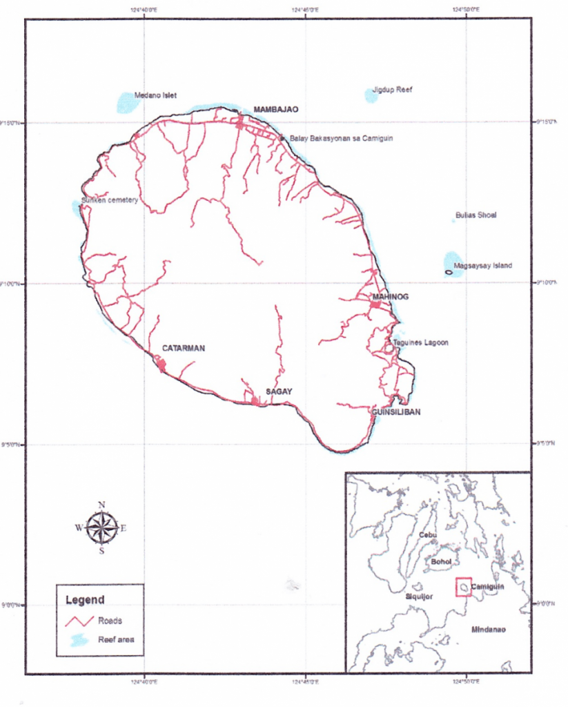
Known as the ‘Island Born of Fire’, Camiguin Island has developed into a resource base for ecotourism and conservation education. With 31 MPA’s in the area it is linking conservation with economics through increasing the visibility of unique biodiversity species through marine protected area establishment and management.
Expedition Location
Camiguin Island lies in the Bohol Sea, between Mindanao and Bohol Islands, about 50 km south of
Bohol. With seven active volcanoes, it is known as the Island Born of Fire. The island’s geology gives
the island its numerous waterfalls, hot springs, and a highly diverse flora and fauna.
In addition, Camiguin is fringed by diverse coral reefs and a growing number of marine protected areas (MPAs)
that attract marine enthusiasts. It is a small island province in the Philippines which
has developed into a resource base for ecotourism and conservation education. In 2008, the
Camiguin Coastal Resources Management Project (CCRMP) was implemented on the island to
mainstream coastal resource management into local government (Phase 1 of the project). In 2012,
the Coastal Conservation and Education Foundation, Inc. was subcontracted as the administrative
arm of the project to implement Phase 2 of the project. This was all done under the support of the
New Zealand Government through the New Zealand Aid Programme.
Throughout Camiguin Island, the project has sought to link conservation with economics through increasing the visibility of unique biodiversity species, especially through marine protected area establishment and management. With 31 marine protected areas around the island, Camiguin, the sustained efforts of the projects
through local government support serves to conserve the marine environment and fisheries as well
as to augment local government income.

Expedition Purpose
This reef monitoring expedition determined the coral reef condition within the marine sanctuaries
in Camiguin Island and its five towns, namely: Mambajao, Mahinog, Guinsiliban, Catarman, and
Sagay. The expedition results will support the current management of Camiguin Island marine
sanctuaries and indicate effectiveness of protection from illegal fishing and improper tourism
activities in the area.
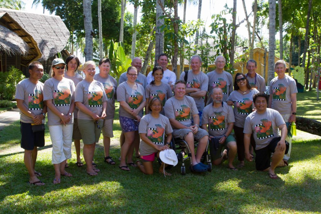
The expedition volunteers including representatives from the Unico Conservation Foundation are experienced scuba divers and most have participated previously in one of the “Saving Philippine Reefs Expeditions”. They made reef surveys using prescribed methods during morning and afternoon dives and snorkels. The first day was mostly dedicated to practice dives to help the divers with their survey skills. Recreational dives were also conducted after survey dives are completed which is always a bonus.

What data was collected?
The dive volunteers and staff made surveys to document the status of the coral reefs in
Camiguin Island by collecting the following information:
- Percent bottom cover of living coral
- Percent bottom cover of non-living reef substrates (e.g. rock, rubble, sand, dead coral)
- Percent bottom cover of other living substrates (e.g. seagrass, algae, sponges)
- Fish species diversity per unit area
- Total number of fish individuals per unit area
- Total number of fish species on the reef
- Number of indicator species per unit area (e.g. butterflyfish, giant clams, lobsters, Triton shells, Crown-of-thorns seastars and others)
- Presence of large marine life (e.g. sharks, manta rays, Bumphead wrasses, sea turtles,
- whales and dolphins, and others)
- Causes of coral damage
- Presence of visitors of intruders in the area
- Effectiveness of management protection in the area
All the data collected was summarised in a report and was disseminated to all interested parties in the
Philippines and elsewhere. It is helping guide and improve management efforts and provide an
indication of the condition of the reefs and marine protected areas in Camiguin Island, Philippines.
The Results


Due to its volcanic history, Camiguin Island is one of the most fertile and lush islands in the Philippines that also boasts a treasury of marine resources. With 31 locally declared marine protected areas (MPAs), and more in the process of being planned, Camiguin Province has shown good leadership and initiative over the past five years in its marine conservation efforts. Already it is becoming a prime tourist destination for foreigners and local tourists alike, with its main attractions ranging from its coral reefs to historical points of interest.
Overall, results in benthic cover varied among sites with the highest percentage live hard coral (LHC) recorded at Balite Marine Sanctuary, Sagay (60.6%) in the shallow reef and 72.3% for the deep coral reef. Much of the damage in some of the sites can be attributed to Typhoon Pablo (or Typhoon Bopha) that swept through the region in 2012.
Fish biomass was low in all the areas, ranging from Very Poor to Poor based on standard measures established for the Philippines. The highest fish biomass recorded was in Mantigue Island, Mahinog at 3.1 kg/500m2. This was also true for fish densities and fish species richness in the study sites of this expedition where numbers rated Very Poor to Poor. The area with highest target fish density was South Poblacion with 208.7 fish/500m2 and it also had the highest all reef fish density with 1,378.7 fish/500m2. The area with highest target fish species richness was Mantigue Island with 17 species/500m2 and it also had the highest all reef fish species richness with 40 species/500m2. A major factor that contributes to the low biomass, low fish densities and low fish species richness is likely to be the lack of enforcement of rules and regulations in some of the MPAs so that fishing is still to be occurring. Another contributing factor is the relatively small size of most of the MPAs. No large marine life was observed in the area except for a few sea turtles in some of the sites. The number of butterflyfish species observed overall totaled 30.
It is recommended by the research team that some of the sites consider increasing their MPA area size to cover more marine habitats (Balite, Cabuan, and Mantigue Island core zone). Further, some sites need marker buoys to delineate MPA boundaries, a feature that is important for visitors and fishers alike (Alangilan and Kabiling-‐Tupsan). Many sites also needed mooring buoys so that visiting boats can moor and avoid dropping anchors and damaging the coral substrate (Alangilan, Lawigan, and Kabiling-‐Tupsan). Although some sites are well managed, others still need more visible patrolling and law enforcement to lessen illegal fishing and other violations. In White Island, there is a need to reconsider where to place the core zone of the MPA where the coral habitat is richer and in consideration of the downstream sink for fish and other larvae.
Overall, it is important for current management groups to maintain and improve current management efforts in Camiguin MPAs where they are already feeling the pressure of tourism and overfishing.
Read the full report hereThe Organisation
Coastal Conservation & Education Foundation
Coastal Conservation and Education Foundation is a non-profit organisation dedicated to the management and sustainable use of Philippine coastal resources through active leadership and participation of coastal communities and stakeholders. Driven by its passion to create sustainable coasts and actively engage communities, CCEF develops and disseminate tools, techniques and research for better marine management, while promoting integrated coastal management approach that includes marine protected areas (MPAs) localized law enforcement and other participatory best practices.
Find out more info here: https://www.coast.ph/
Partners


